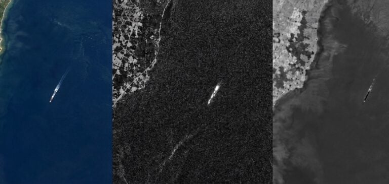

Newer missile threats, including hypersonic glide vehicles, low-flying cruise missiles and mobile solid-fuel systems, are shrinking the time available to respond. Today’s warning architecture relies heavily on space-based infrared satellites, such as the US Space-Based Infrared System (SBIRS), which detect the intense heat of a missile’s boost-phase plume. Radar and other sensors then track the missile through the remainder of its flight.
Detection at ignition, however, leaves little margin for response.
Analysts are therefore looking earlier in the chain. Pre-launch indications and warning (I&W) applies Earth observation (EO) over time to missile-related infrastructure and the surrounding terrain, revealing activity before a missile is fired. Shortwave infrared (SWIR), working alongside radar, optical and other data, adds a view of materials and moisture that standard optical imagery does not capture. It helps analysts decide where to look and how much confidence to place in what they find.
The Pre-Launch Window: Shifting Left of Launch
The aim is to identify indicators before a weapon is fired. Missile operations are not isolated events; they depend on infrastructure, logistics and preparation on the ground. Individually, the signs can be subtle, such as a cleared area, a new track or a modified building. Taken together, and across several sensors, they form a picture that begins well before ignition.
TWO LAYERS OF WARNING, WORKING TOGETHER
Early indicators (EO, including SWIR): built up over days to weeks of repeat passes, tracking changes in infrastructure, ground disturbance and activity patterns.
Boost-phase detection (SBIRS-class infrared satellites): at and immediately after launch, detecting the heat plume of the rising missile for launch confirmation and tracking.
What SWIR Reveals on the Ground
SWIR covers wavelengths just beyond what standard cameras see, roughly 1,000 to 2,500 nm in the broad sense, and SWIRSAT’s four bands span about 1,270 to 1,650 nm. Because SWIR reads reflected sunlight, it is collected in daylight and responds to what surfaces are made of and how much water they hold. Its longer wavelengths also scatter less, extending usable collection through haze and thin smoke where visible imagery degrades.
1. Revealing camouflage and concealment
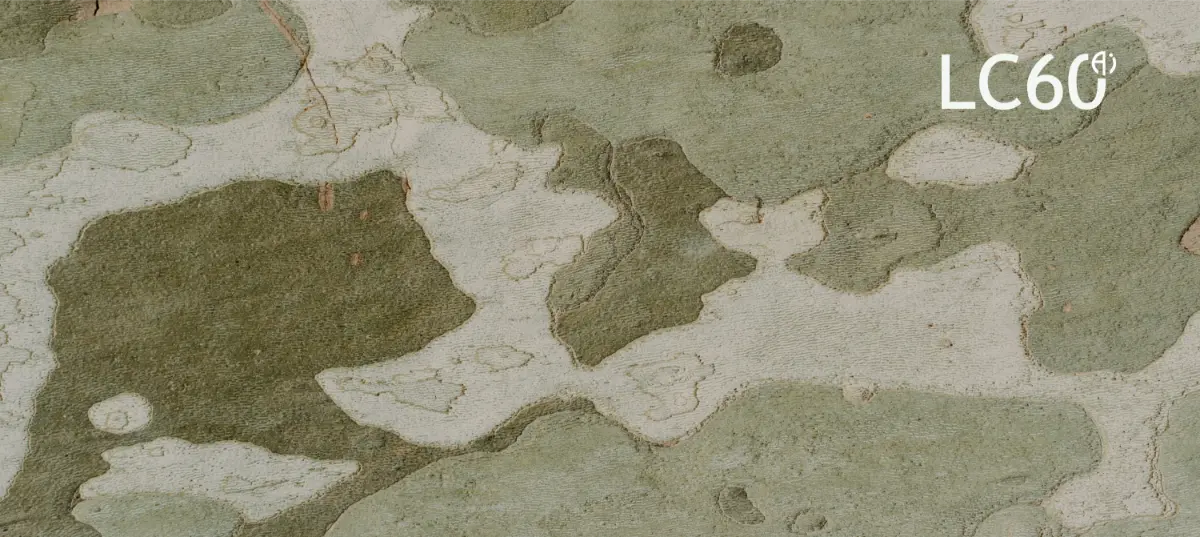
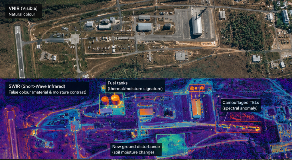
- Real versus artificial cover: vegetation is rich in water, which absorbs SWIR strongly, while many synthetic materials behave differently. Camouflage that blends in at visible wavelengths can therefore stand out in SWIR, particularly in dry and arid environments. In greener terrain, VNIR vegetation mapping can be paired with the SWIR view to separate natural from artificial cover.
- Patterns over platforms: SWIRSAT’s Super HD product resolves the footprint of hardstands, access routes and support facilities. Across successive collections, the pattern of activity at these sites is more telling than any single vehicle.
2. Spotting ground disturbance
- Surface footprints: soil compaction, vegetation clearing and vehicle tracks alter surface moisture and reflectance. SWIR can reveal these changes where standard imagery shows little, and comparing new imagery against a baseline shows how a site evolves.
- Large-area signatures: site preparation can affect areas measured in hectares, where multi-band SWIR analysis is strongest. Narrower features, such as individual tracks, are cued by SWIR and confirmed by complementary sensors.
3. Material and chemical indicators
Fuel, propellant and chemical-residue indicators are among the applications LC60 has identified for SWIRSAT. As the constellation grows, later satellites are planned to extend toward the ~2,000 nm region, where many materials become easier to tell apart, adding depth to this work.
Multi-Sensor Fusion: Turning Detections Into Assessments
No single sensor settles the question; confidence comes from convergence. Each has a distinct role, and in built-up or complex terrain SWIR is at its best paired with SAR and high-resolution optical data:
| Sensor Category | Role in Pre-Launch Monitoring |
|---|---|
| Synthetic Aperture Radar (SAR) | All-weather, day-and-night collection that confirms physical structures and flags change and equipment staging at known sites. |
| Short-Wave Infrared (SWIR) | Turns a SAR or optical detection into an assessment: is the change consistent with normal activity, surface cover or camouflage? |
| Thermal Infrared (MWIR and LWIR) | Senses emitted heat, day and night, adding indicators of active equipment and facilities. |
| High-Resolution Optical (VNIR) | Fine structural detail and visual identification in clear conditions. On SWIRSAT-1 this comes from a co-registered payload in the same mission design, which avoids the alignment delays of fusing data from separate constellations. |
SWIRSAT: Purpose-Built for the Mission
SWIRSAT is an Australian-owned constellation developed to deliver operational-grade SWIR imagery for defence, security and sovereign government users, with public funding support from the Australian Space Agency and the Government of Western Australia.
- Launch: the first two satellites, SWIRSAT-1 and SWIRSAT-2, are planned for Q1 2027.
- Resolution: SWIR at 8 m native and 4 m Super HD. On SWIRSAT-1, VNIR at 1.5 m native and 75 cm Super HD, plus a panchromatic band.
- Coverage and growth: an 11 km swath at nadir and a revisit of about 4 to 7 days for SWIRSAT-1 (10 days for SWIRSAT-2), depending on latitude. LC60’s roadmap adds satellites toward daily global revisit with nine or more, at better than 3 m native resolution, subject to demand.
- Analytics-ready, sovereign data: GeoTIFF imagery with STAC metadata for standard GEOINT workflows, delivered by API, secure cloud transfer or, for defence and security customers, direct downlink to customer-controlled ground stations.
- On-orbit analytics: AI analytics running on the satellite are designed to reduce data volumes and speed the path from collection to alert.
Built to Work as Part of the Team
SWIRSAT is designed as a complementary layer that plugs into existing processing, exploitation and dissemination workflows alongside SAR, optical, thermal and SIGINT. In practice:
- Indicators that guide action: SWIRSAT outputs are probabilistic indicators that cue higher-resolution or classified collection and support analyst judgement. They are not launch predictions.
- Baselines pay off: change detection improves with a strong reference history. LC60’s pre-order framework, which offers reserved capacity and priority tasking, lets organisations start building that history over their areas of interest before the constellation is commissioned.
A Sharper Layer for Earlier Insight
Early indicators do not replace boost-phase detection; they widen the warning window. SWIR gives that early view its clarity, resolving ambiguity where optical and radar data fall short. With SWIRSAT, LC60 is building the integrated SWIR layer to make that possible.
Organisations planning ahead can engage with LC60 now. To learn more, visit www.lc60.ai.