Emissions Visibility. Operational Integrity.
LC60 delivers satellite-based methane monitoring, emissions verification, and wide-area infrastructure surveillance for upstream operators, midstream networks, and resource majors operating across remote and sensitive environments.
Built for the missions that matter.
Five operational capabilities — each enabled by sovereign SWIR observation.
A licence-to-operate requirement.
Disclosure mandates, investor expectations, and regulatory regimes — from UN OGMP 2.0 to national methane regulations — have made independent emissions verification a licence-to-operate requirement. SWIRSAT’s spectral capabilities make methane and other hydrocarbon emissions directly observable from orbit.
LC60 currently supports oil and gas operators across multi-year methane monitoring contracts and is positioned to scale this capability as SWIRSAT enters operation.
Three production-grade capabilities.
Independent. Repeatable. Audit-ready.
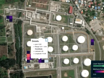
Methane Detection & Quantification
Satellite-based detection of fugitive emissions across upstream production, midstream transport, and processing infrastructure.
Site-Level Environmental Compliance
Surface change and disturbance monitoring across resource extraction, tailings, and rehabilitation areas.
Wide-Area Infrastructure Surveillance
Periodic spectral monitoring of remote pipelines, wellheads, and processing facilities — including in cloud-prone and high-latitude regions.
Common questions
LC60 monitors methane plumes from upstream and midstream infrastructure, broader greenhouse-gas inventories at facility scale, and the physical state of assets (wellpads, gathering lines, storage, flare stacks, access roads). The same satellite tasking also supports leak detection, encroachment, and unauthorised activity around remote sites.
Detection sensitivity depends on wind, surface, and time of day. With a properly tasked SWIR collection, LC60 can typically resolve large super-emitter events (hundreds to thousands of kg/h) on a per-pass basis, and produce facility-level annual inventories by aggregating many observations. We pair the satellite tier with site-level instruments for events that fall below orbital detection thresholds.
OGMP 2.0 requires operators to report at Level 4 (source-level measurement) and Level 5 (site-level reconciliation). LC60’s stack contributes the site-level satellite record that supports Level 5 reconciliation, and integrates with ground-based and aerial measurement campaigns at Level 4. The output is structured for direct ingestion into operator MRV systems and external auditor review.
Yes. Wide-area surveillance is one of the production-grade capabilities: spectral change detection identifies hydrocarbon spills, vegetation stress around buried infrastructure, third-party encroachment on rights-of-way, and unauthorised pad construction. Alerts can be routed to operations, security, or community-relations teams depending on the event type.
LC60 delivers data through secure API integration, allowing methane alerts, monitoring outputs, and geospatial intelligence to plug directly into your existing SCADA, ESG, GIS, or operational systems.. Delivery cadence can be configured for routine reporting, active monitoring, or incident response
Yes — this is a core use case. Satellite observation does not require ground access or local permits, which makes it the only practical option for some offshore platforms, transboundary pipelines, and assets in conflict-adjacent regions. LC60 operates from Australian-jurisdiction infrastructure and can monitor under data-sovereignty arrangements where the customer requires.
Emissions you can see. Compliance you can prove.
Speak with our resources team to scope a tailored monitoring programme for your asset portfolio.