
For years, satellite ISR has been measured in familiar terms: spatial resolution, revisit frequency, geographic coverage. These still matter, but operational experience across maritime security, land operations, and post-event assessment points to a more fundamental constraint they don’t capture. Imagery can be successfully collected and still fail to deliver a confident answer. The bottleneck isn’t collection — it’s interpretability.
The Limits of Seeing
Modern operations increasingly take place in degraded, denied, and deceptive environments, where traditional multi-spectral imagery is constrained in two ways.
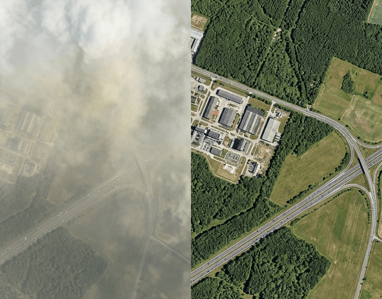
The first is environmental. Visible and near-infrared (VNIR) imagery is vulnerable to smoke, haze, dust, aerosols, coastal humidity, and post-event debris — effects most pronounced at dawn, dusk, and low-contrast conditions. The imagery exists, but it doesn’t tell analysts what they need to know.
The second is deliberate. Adversaries increasingly use concealment and deception measures designed to exploit the limitations of multi-spectral sensing — camouflage, decoys, terrain masking. These don’t aim to prevent collection; they aim to undermine interpretation, producing false confidence, missed detections, or delayed confirmation.
The combined effect is decision uncertainty propagating through the intelligence cycle — longer tasking timelines, greater reliance on costly airborne platforms, and degraded efficiency in cueing higher-value ISR assets.
A Different Physical Mechanism
Short-wave infrared (SWIR) sensing addresses this gap by operating through physical interaction mechanisms distinct from the visible spectrum. Rather than relying on purely visual interpretation, SWIR enables cross-spectral analysis — assessing material state, surface disturbance, and moisture-related characteristics that remain ambiguous or fully obscured in VNIR imagery.
Operating around 1650 nm, SWIR exhibits reduced sensitivity to atmospheric scattering while responding directly to material composition and moisture content. It isn’t all-weather in the way SAR is, but it extends the effective collection window under obscuration and low contrast — making it particularly suited to confirmation, discrimination, and anomaly detection, the stages where decision confidence is most often lacking.
SWIR doesn’t compete with optical, SAR, or thermal systems for the detection mission. It strengthens what happens after detection, when an analyst needs to know not just that something is there, but what it is and whether it can be trusted.
From Contextual Layer to Decision Input
Despite this recognised value, space-based SWIR remains structurally under-supplied. Airborne SWIR platforms are routinely used tactically, but space-based equivalents haven’t matured at a pace matching the growing requirement for persistent, scalable ISR support.
Where space-based SWIR datasets do exist, they’re often constrained by resolutions insufficient for tactical analysis, infrequent revisit, and delivery as standalone imagery poorly aligned with VNIR, SAR, or thermal datasets — leaving SWIR adjacent to core ISR architectures rather than integrated as a foundational layer. Closing this gap requires capability built for operational-grade resolution, scalable persistence, and seamless integration into analytics-driven workflows.
Where SWIR Earns Its Place
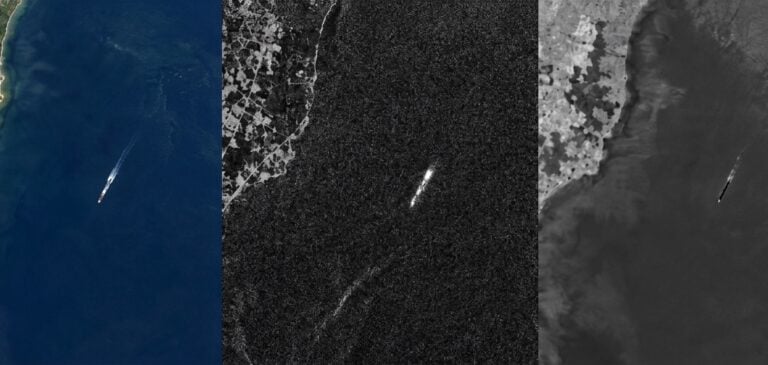
In maritime domain awareness, SWIR sustains usable surveillance in high atmospheric moisture and sea mist that degrade optical reliability, enhancing wake signatures and movement patterns that support tracking and intent assessment — particularly valuable when fused with RF and SAR to close attribution gaps on non-cooperative vessels.
In infrastructure monitoring, SWIR reveals changes in surface condition and material properties invisible to optical imagery: compacted soil, disturbed ground, concealed routes, altered drainage. Because vegetation cover and surface masking have limited effect on SWIR-derived indicators, it remains useful precisely where visual interpretation alone is inconclusive.
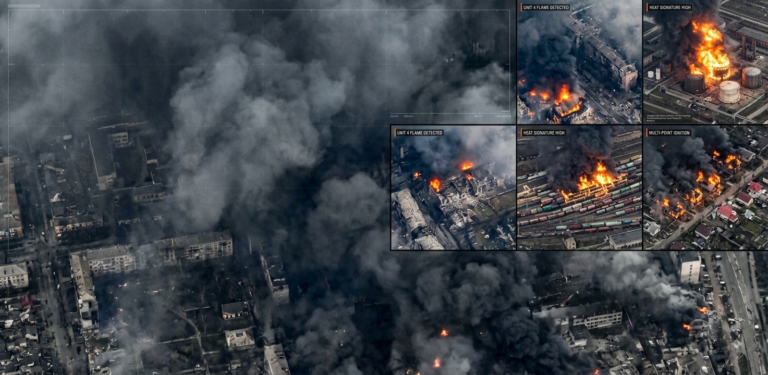
In post-event assessment, SWIR can see through smoke and debris following fires or kinetic activity, accelerating the restoration of situational awareness. And in counter-concealment, its sensitivity to material and surface characteristics supports detection of camouflage netting, decoys, and structures designed to read as terrain.
Closing the Latency Gap On-Orbit
Reducing decision uncertainty is only half the problem; the other half is time. A confirmed assessment that arrives too late carries little more value than an ambiguous one delivered promptly.
On-orbit AI analytics addresses this by shifting selected processing to the point of collection, rather than waiting for raw data to be downlinked and queued on the ground. This reduces data volumes, accelerates the transition from collection to alert, and ensures urgent material isn’t stuck behind routine imagery. Paired with SWIR’s confirmation strengths, the result is a much shorter path from sensor to decision-maker — less a matter of better imagery, and more a matter of faster intelligence.
The Shift From Imagery to Intelligence
What unites these use cases is a shift in what ISR is being asked to deliver. The historical framing — more resolution, more revisit, more coverage — assumed the limiting factor was visibility. Increasingly, the limiting factor is confidence.
SWIR’s role is not to replace the sensors that do the seeing. It’s to reduce the uncertainty that persists after seeing has happened — closing the gap between collection and the moment a commander can actually rely on what’s been collected. That gap is exactly where the next generation of ISR capability needs to be built.
LatConnect 60 is developing this capability now. Its SWIRSAT constellation is bringing operational-grade, persistent space-based SWIR to market, with the first satellites launching in late 2026 and early 2027 — closing the gap this article describes and making the missing layer in modern ISR available sooner than the market has come to expect.