Advanced Disaster Assessment via SWIR
Operational intelligence for disaster response in contested, obscured environments. Enabling faster, safer, data-driven decisions when visibility is compromised.
From Obscured to Actionable
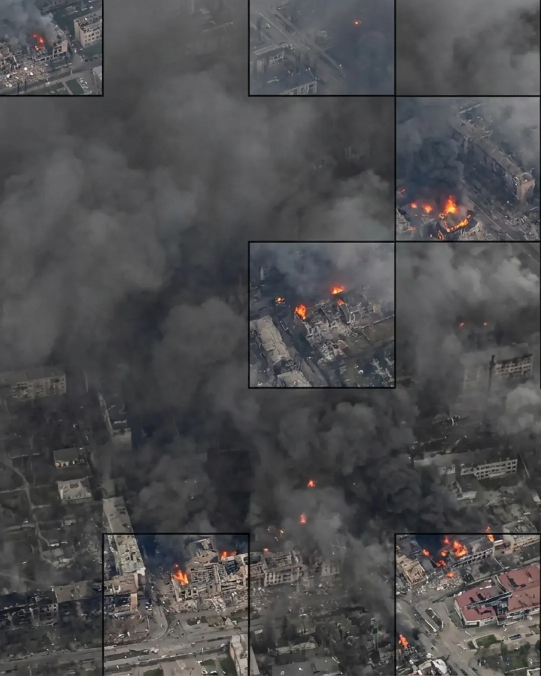
Standard optical imagery fails when it matters most
Optical imagery degraded by smoke and atmospheric interference leaves commanders with limited situational awareness and delayed decision-making in active disaster events.
Smoke, haze, and partial cloud cover blind visible-light sensors precisely when intelligence is needed most.
When optical systems fail, intelligence collection halts, forcing commanders to act on stale or incomplete data.
Heat-affected surfaces and structural collapse hidden beneath smoke are indistinguishable in visible bands.
Imaging beyond visibility limits
SWIRSAT captures data in the Short-Wave Infrared spectrum (1000–1750 nm), enabling visibility through smoke, haze, and partial cloud cover. SWIR leverages material reflectance properties, not just visible light — allowing continuity of intelligence collection during active disaster events when optical systems fail.
SWIR-enhanced imagery reveals heat signatures and fire zones even when optical imagery is fully obscured.
Material reflectance contrast identifies compromised buildings and collapse patterns hidden under smoke.
Continuous geospatial intelligence on infrastructure condition, accelerating coordinated disaster response.
Three capabilities only SWIR delivers
SWIR enables intelligence that visible-light sensors physically cannot provide in disaster environments.
Separate intact buildings from compromised ones by analyzing material reflection signatures across the SWIR band.
Pinpoint high-intensity heat-affected surfaces and damaged roofing invisible to the eye in standard optical imagery.
Uncover subtle collapse patterns and structural failures hidden under smoke or optical "noise" that defeats visible-light systems.
Participate in SWIRSAT’s Pre-Order Framework
Reach our defense team for an NDA-first briefing on how SWIR-enabled ISR can support your disaster response and operational objectives.